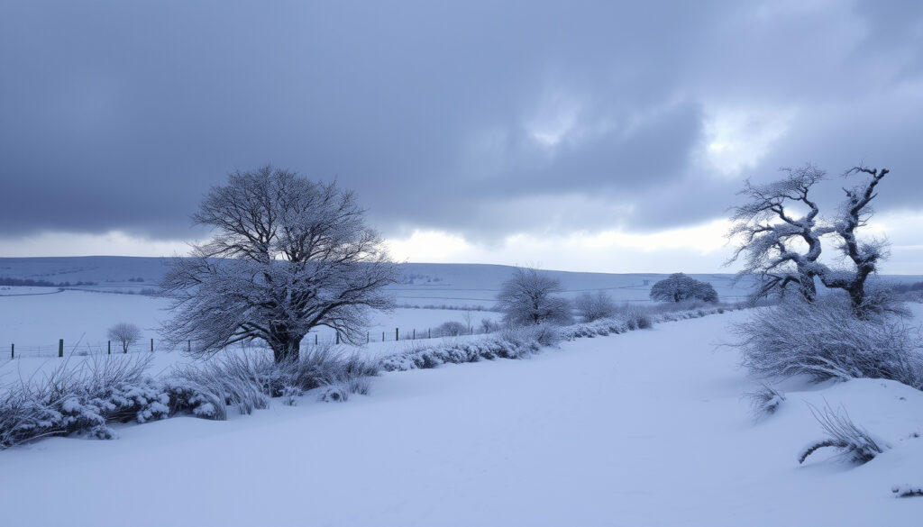
Ireland Weather Alert: Snow & Storm Amy from Met Éireann
Irish weather has a way of keeping everyone guessing — one week you’re sweltering in a heatwave, the next you’re checking for snow alerts. With Met Éireann’s three-tier warning system and the arrival of Storm Amy, the first named storm of the 2025/26 season, knowing what each alert means has never been more practical. This guide walks through the latest warnings, what Storm Amy means for your county, and how to read the signals that matter most.
Met Éireann warning levels: Yellow, Orange, Red ·
Lowest temperature in snow warning: -4°C (air minima) ·
Storm Amy dates: 3–4 October 2025 ·
Storm Amy storm status: First named storm of 2025/26 season
Quick snapshot
- Storm Amy named by the UK Met Office as first storm of 2025/26 season (Met Éireann)
- Red wind warning issued for Donegal on 3 October 2025 (Met Éireann) (Met Éireann)
- Orange wind warnings active for five western counties (The Irish Times)
- Whether Ireland will see snow during Christmas 2025
- Exact path and intensity of Storm Amy beyond basic forecast
- Snowfall amounts for winter 2025/26
- Monitor Met Éireann live warning map for updated alerts
- Prepare for potential orange and red warnings through winter
- Check 7-day forecasts in late December for Christmas snow outlook
Eight key facts about Ireland’s snow warning system and Storm Amy, one pattern: the difference between a warning level can mean the difference between disruption and danger.
| Label | Value |
|---|---|
| Highest snow warning level | Red (rare) |
| Storm Amy named date | October 2025 |
| Met Éireann snow warning threshold | Air minima -3°C to -4°C |
| Typical snow-prone region | Wicklow Mountains |
| Snow/ice warning criteria | 3 cm or more in 24 hours |
| Red wind warning area | Donegal county |
| Storm Amy impact date | 3 October 2025 |
| Orange warning counties | Donegal, Galway, Leitrim, Mayo, Sligo |
Is Ireland going to get snow in 2026?
Long-range snow forecasts for Ireland
- Met Éireann does not issue seasonal snow forecasts — rely on historical averages and short-term warnings.
- Average snowfall in Ireland varies by region, with highest amounts in mountainous areas.
Met Éireann’s official guidance cautions that long-range snow predictions are not part of their forecasting remit. Instead, the national meteorological service issues warnings up to 48 hours in advance when snow or ice is expected to meet defined thresholds. For winter 2025/26, the only concrete signal so far is Storm Amy’s arrival in early October — a reminder that the season has started early.
Historical data offers the best proxy. Average snowfall in Ireland ranges from under 10 days per year in lowland areas to more than 30 days in the Wicklow Mountains and upland parts of Donegal, according to Met Éireann’s own climate records. The pattern: snow is possible but rarely persistent at sea level.
Long-range snow forecasts for Ireland simply don’t exist at the seasonal scale. Anyone promising a “snowy winter 2026” prediction is guessing, not forecasting. The only reliable data comes 48 hours out from Met Éireann’s warning system.
Historical snowfall patterns in Ireland
- Snow is most common in the Wicklow Mountains, Donegal, and Connemara.
- Met Éireann issues localized warnings with affected areas for each event.
Ireland’s snowfall history shows a clear geographic split. Eastern counties and mountainous regions see the bulk of accumulations, while western coastal areas rarely get lasting snow. The Met Éireann cold-weather commentary noted that wintry showers of hail, sleet and snow were expected at times, with the possibility of severe frost and ice — particularly over high ground in eastern counties.
Where is the snow in Ireland?
Current snow accumulation by county
- As of the latest Met Éireann updates, no active snow warnings are in effect — the current focus is on Storm Amy wind and rain alerts.
- Snow warnings typically activate between November and March.
As of early October 2025, the weather headlines are dominated by Storm Amy, not snow. Met Éireann has issued red and orange wind warnings for western and northern counties, with no snow component in the current alerts. Snow accumulation maps only become active when Met Éireann’s criteria are met — 3 cm or more in 24 hours for a snow/ice warning.
What this means: the question “where is the snow right now?” has a short answer — nowhere yet. But the warning infrastructure is ready and tested.
Mountainous regions most prone to snow
- The Wicklow Mountains, the Mourne Mountains, and the Derryveagh Mountains in Donegal see the most consistent snowfall.
- Met Éireann’s localized warnings specify affected areas down to county level.
When snow does arrive, it typically settles first and longest in Ireland’s mountain ranges. The Met Éireann winter outlook highlighted that snow was possible over high ground in eastern counties, a pattern consistent with decades of climate data. For residents in these areas, a yellow snow warning is a familiar signal to check road conditions before heading out.
Mountainous counties don’t just see more snow — they see snow earlier and later in the season. A yellow warning in the Wicklow Mountains can coexist with completely clear conditions in Dublin city, 30 km away.
The takeaway: snow in Ireland is a localised phenomenon driven by elevation, and the warning system reflects that geography.
Is storm Amy going to hit Ireland?
Storm Amy’s predicted path and timing
- Storm Amy was named by the UK Met Office and impacted Ireland on Friday 3 October 2025.
- The track brought the storm directly over western and northern counties.
Yes — Storm Amy made landfall in Ireland on 3 October 2025, becoming the first named storm of the 2025/26 season. Met Éireann confirmed that the storm’s track had not changed, but forecast models had upgraded the probability of a red warning for Donegal. The red warning was active from 4 pm to 6 pm on 3 October, with extremely strong wind gusts.
Schools closed at midday in four counties, BBC News reported, as authorities moved to keep children off the roads during the worst of the storm. Orange wind warnings covered Donegal, Galway, Leitrim, Mayo and Sligo from 2 pm to 10 pm.
Expected wind speeds and rainfall
- Winds in the marine warning could reach violent storm force 11.
- Orange-level winds were expected to damage power lines and topple trees.
The Irish Times reported that a status red marine warning was issued for Friday from Loop Head to Rossan Point and Fair Head, with winds reaching violent storm force 11. On land, the orange warning for Donegal, Galway, Leitrim, Mayo and Sligo carried the risk of fallen trees, damaged power lines, and very difficult travelling conditions.
Kerry was placed under an orange alert earlier on 2 October, with flooding and dangerous road conditions expected until 8 pm. The storm’s twin threats — wind and rain — made it a multi-hazard event rather than a simple windstorm.
Will it snow this Christmas in Ireland?
Historical Christmas snow in Ireland
- White Christmases are rare in Ireland; the last widespread snow was 2010.
- Met Éireann records show measurable snow on Christmas Day only a handful of times since 1960.
The short answer from meteorologists: don’t bet on it. Met Éireann’s historical data shows that widespread snow on Christmas Day has occurred only a handful of times in the past six decades, with 2010 being the most memorable — much of the country saw accumulations of 10-20 cm. But those events are the exception, not the rule.
Ireland’s maritime climate, moderated by the Atlantic Ocean, tends to keep temperatures above freezing in lowland areas during December. Snow at Christmas typically requires a perfect storm of cold easterly winds and low pressure systems — a combination that doesn’t align often.
Current winter outlook from Met Éireann
- No official Christmas snow forecast is available this far ahead.
- Met Éireann advises checking 7-day forecasts in late December for the best indication.
As of October 2025, it’s impossible to say whether Christmas 2025 will see snow. Met Éireann’s operational forecasting covers a maximum of 7-10 days, and seasonal outlooks are not issued for specific holidays. The best advice: check the forecast on 20 December for a reliable picture.
If you’re hoping for a white Christmas in Ireland, watch for a sustained easterly airflow in the week before 25 December. That’s the pattern that delivered 2010’s snow — and it’s the only pattern that reliably brings snow to lowland Ireland in December.
The pattern: white Christmases in Ireland are outliers, not expectations, and the forecasting system is honest about that limitation.
What are the current Met Éireann weather warnings for snow?
Yellow, orange, and red snow warnings explained
- Yellow: localized snow/ice, possible travel disruption.
- Orange: widespread snow, significant disruption expected.
- Red: rare and very dangerous — air minima of -3°C to -4°C over a wide area.
Met Éireann’s three-tier warning system is the backbone of Ireland’s weather preparedness. For snow and ice, the thresholds are tied to measurable criteria. A yellow snow warning is triggered when 3 cm or more of snow is expected in 24 hours, or when ice is likely to cause hazardous surfaces. An orange warning means widespread snow with significant disruption to transport and daily life.
A red snow warning is the most severe. Met Éireann describes it as a rare and very dangerous weather condition from intense meteorological phenomena. The specific threshold: air minima of -3°C or -4°C expected over a wide area, with dangerous surfaces due to ice and/or lying snow. Red warnings are issued only when there is a genuine risk to life and property.
Three warning levels, one pattern: yellow means be aware, orange means be prepared, red means take action. The distinction matters because the wrong response to a red warning can be life-threatening.
How to check the latest snow warnings
- Visit Met Éireann’s official warnings page at met.ie/weather-warnings.
- Warnings are updated every 12 hours or as conditions change.
- Follow Met Éireann on social media for real-time updates.
The most reliable source for live snow alerts is Met Éireann’s own warnings portal, which displays a colour-coded map of Ireland showing all active warnings. The map is updated every 12 hours, or more frequently when conditions are rapidly evolving. During Storm Amy, Met Éireann used the same system to push red and orange wind alerts, demonstrating its effectiveness for multi-hazard events.
For mobile users, the Met Éireann app provides push notifications for warnings in your area. The BBC News coverage of Storm Amy noted that schools and local authorities relied on Met Éireann’s warning system to make closure decisions — a real-world test that the system passed.
Timeline
- 3–4 October 2025: Storm Amy impacts Ireland — red wind warning for Donegal, orange warnings for five counties, red marine warning for coastal waters.
- Winter 2025/26: Potential snow events; Met Éireann issues alerts based on 3 cm/24h threshold.
- Christmas 2025: Possible snow, based on historical patterns; no reliable forecast available until December.
- July 2026: Heatwave advisory issued; no snow warnings active.
What’s clear and what’s not
Confirmed facts
- Storm Amy named and dated (3–4 Oct 2025) — Met Éireann
- Met Éireann issues three-tier warning system (Yellow, Orange, Red) — Met Éireann
- Red wind warning for Donegal on 3 October 2025 — The Irish Times
- Schools closed in four counties due to Storm Amy — BBC News
- Snow/ice warning criteria: 3 cm or more in 24 hours — Met Éireann
- Red snow warning threshold: air minima -3°C to -4°C — Met Éireann
What’s unclear
- Whether Ireland will see snow during Christmas 2025
- Exact path and intensity of Storm Amy beyond basic forecast
- Snowfall amounts for winter 2025/26
- Whether the 2025/26 season will bring above-average snow
- Exact timing of potential snow events during winter 2025/26
- Whether the current storm season will bring additional named storms
Official voices
“Air minima of minus 3C or minus 4C expected over a wide area… Dangerous surfaces due to ice and/or lying snow.”
— Met Éireann, describing the threshold for a red snow warning
“Storm Amy is the first storm of the 2025/26 season and has been named by the UK Met Office.”
— Met Éireann, confirming the storm’s status
“A status orange wind warning for Donegal, Galway, Leitrim, Mayo and Sligo valid from 2 pm to 10 pm on 3 October 2025.”
— The Irish Times, reporting on Storm Amy’s impact
“Schools were to close at midday in four counties due to Storm Amy.”
— BBC News, on the storm’s disruption to education
The pattern across all of this is consistent: Ireland’s weather warning system is designed to be read, understood, and acted upon. Met Éireann’s three-tier framework gives every resident a clear signal — yellow means watch, orange means prepare, red means act. For anyone living in Ireland, the choice is straightforward: learn the system, monitor the warnings, and when a red alert lands, take it seriously. The alternative is risking roads, property, and safety in conditions that Ireland’s meteorologists have already flagged as dangerous.
en.wikipedia.org, met.ie, reddit.com, instagram.com, facebook.com, facebook.com, facebook.com, watchers.news
Frequently asked questions
What does a yellow snow warning mean?
A yellow snow warning from Met Éireann indicates localized snow or ice that may cause disruption to travel and daily activities. The threshold is 3 cm or more of snow in 24 hours, or ice creating hazardous surfaces. It’s the lowest level of alert and means “be aware.” (Met Éireann)
How often does Met Éireann update snow warnings?
Met Éireann updates its warnings every 12 hours as a standard schedule, or more frequently when conditions change rapidly. During active storm events like Storm Amy, updates can come within hours as forecast models refine. The live warnings map at met.ie is the most current source. (Met Éireann)
Can I travel during a red snow warning?
Met Éireann advises against all non-essential travel during a red warning. A red snow warning means air minima of -3°C to -4°C over a wide area with dangerous surfaces due to ice and lying snow. Roads become treacherous, and the risk of accidents is significantly elevated. Authorities recommend staying indoors until the warning expires. (Met Éireann)
Where is the best source for live snow alerts?
The most reliable source is Met Éireann’s official warnings page (met.ie/weather-warnings), which shows a colour-coded map of all active warnings. The Met Éireann mobile app also provides push notifications for your area. During major events, RTÉ and the Irish Times provide supplementary coverage. (Met Éireann)
What should I do if a red snow warning is issued?
Take immediate action to protect yourself and your property. Secure outdoor items, avoid travel, and ensure you have supplies to stay indoors for the duration of the warning. Met Éireann describes red warnings as “rare and very dangerous” — they are issued only when there is a genuine risk to life. Follow updates from Met Éireann and local authorities. (Met Éireann)
Does Storm Amy bring snow or just wind and rain?
Storm Amy is primarily a wind and rain event, not a snow event. As the first named storm of the 2025/26 season, it brought violent storm-force winds (up to force 11 at sea) and heavy rain to western and northern counties. Snow is not a component of the current Storm Amy warnings. Snow events typically occur later in the winter, from November through March. (The Irish Times)
How does Ireland compare to other countries in snow frequency?
Ireland experiences significantly less snow than most of continental Europe and the UK’s eastern regions. The maritime climate keeps winter temperatures relatively mild, especially in western coastal areas. Average snowfall ranges from under 10 days per year in lowlands to over 30 days in mountainous areas. By comparison, Scotland sees 15-20 days of snow annually in lowland areas, and countries like Sweden or Canada see 60-100+ days. (Met Éireann)
More related posts
 Woodies Lucan Opening Hours: Store Hours, Discounts & Pay
 Met Éireann Christmas Forecast: Will Ireland See White Christmas
 Que Manger Apres Lentrainement – Complete Nutrition Guide
 How to Relieve Stress: Evidence-Based Tips That Actually Work
 Biggest Country in the World – By Area, Population and GDP
 Big Brother 2025 Cast: Full List of Housemates & Lineup Revealed
 Jean-Clair Todibo: Salary, Transfer, and Career Facts
 When Is PS6 Coming Out – Rumors Point To 2027-2028